5 Municipal Drainage Mistakes (And How Better Data Fixes Them)
February 18, 2026
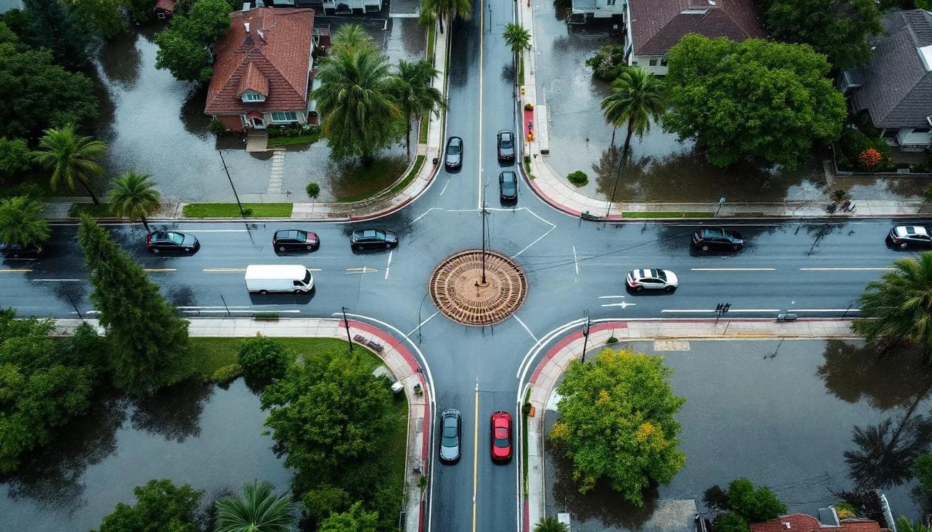
Municipal drainage infrastructure is expensive to build, expensive to repair, and extremely expensive to get wrong. When a culvert is undersized, a detention basin underperforms, or a storm sewer route misses the actual flow path, the costs compound: construction rework, continued flooding complaints, potential property damage claims, and erosion of public trust.
Most drainage project failures trace back to the planning phase — specifically, to decisions made with insufficient or inaccurate data. Here are the five mistakes we see most often, and how each one is preventable with the right approach to terrain intelligence.
Mistake 1: Using Outdated Topographic Maps
This is the most pervasive and most costly mistake. Many municipalities base drainage design on topographic data that was collected years or decades ago. According to the American Society of Civil Engineers' Infrastructure Report Card, the nation's stormwater infrastructure consistently receives near-failing grades, with outdated data cited as a contributing factor. In areas that have seen development, grading, or significant weather events since the last survey, the terrain depicted in these maps may bear little resemblance to what exists today.
A subdivision built since the last survey changes the drainage patterns of every parcel downhill. Fill placed for a commercial pad alters the effective watershed boundary. Even routine road maintenance and utility work gradually modify surface grades in ways that legacy maps don't capture.
The fix: Commission current, high-resolution terrain data for the project area before beginning design. Drone LiDAR provides sub-5 cm accuracy and can cover a typical municipal project area in a day. The cost of the scan is a small fraction of the project budget and eliminates the foundational uncertainty that undermines everything built on top of it.
Mistake 2: Ignoring Upstream Development Changes
Drainage systems are designed for a specific contributing watershed area and impervious percentage. When development occurs upstream — new rooftops, parking lots, roads — runoff volume and peak flow rate increase. If the downstream drainage system was designed before that development occurred, it may now be undersized.
This is not a hypothetical risk. It happens routinely in growing communities. A storm sewer designed for a mostly agricultural watershed now receives runoff from a subdivision of 200 homes. The system that handled a 10-year storm before development now overflows during a 5-year event.
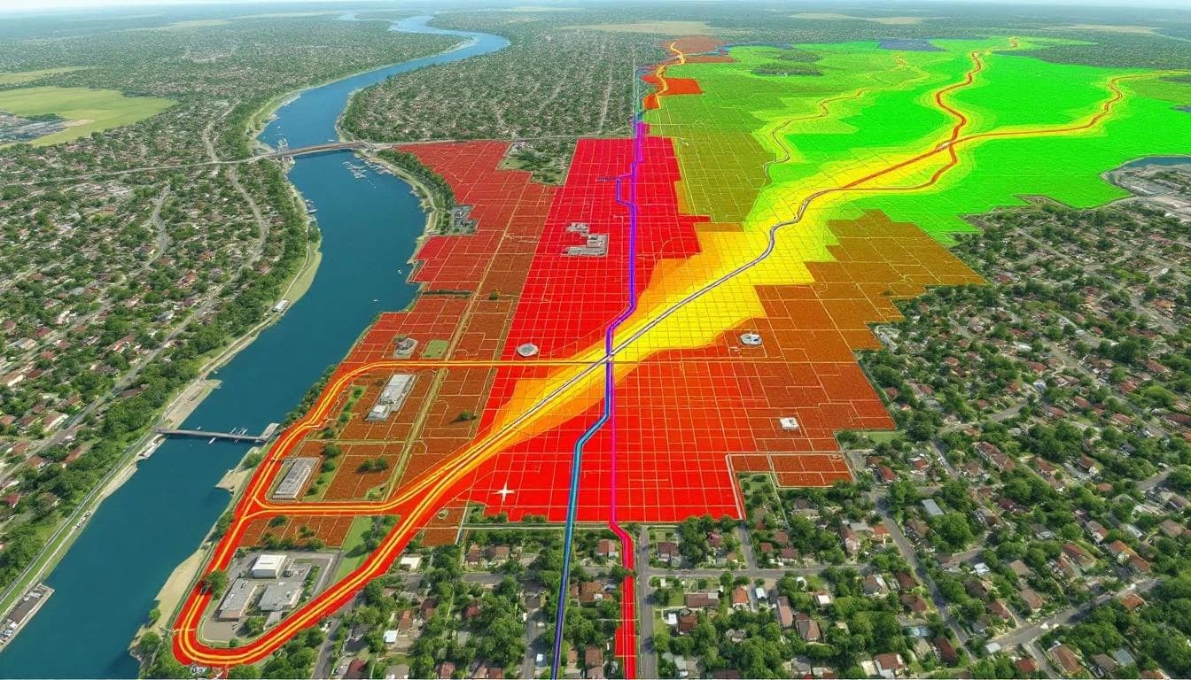
The fix: When planning drainage improvements, always analyze the current contributing watershed using current terrain and land cover data. Don't rely on the watershed delineation from the original design. Development may have redirected flow, added impervious area, or changed the effective drainage boundary. A current LiDAR-derived DEM with flow analysis provides the accurate watershed data needed for proper sizing.
Mistake 3: Designing for Historical Rainfall Instead of Current Patterns
Drainage infrastructure is designed to handle a specific design storm — typically the 10-year, 25-year, or 100-year event defined by historical rainfall statistics. But rainfall patterns are changing. NOAA's Climate Normals data confirms that many regions are experiencing increases in high-intensity, short-duration rainfall events — exactly the type that stresses drainage infrastructure the most.
A system designed for a 10-year storm based on 1980s rainfall statistics may actually be handling the equivalent of a 5-year storm under current precipitation patterns. NOAA Atlas 14, NOAA's precipitation frequency data, has been updated for many regions but not all, and the rate of change continues to accelerate.
The fix: Use current precipitation data in design calculations, and consider modeling a range of storm intensities rather than a single design event. Rainfall simulation on a high-resolution DEM shows exactly how the system performs under different storm scenarios — allowing engineers to size infrastructure for current and projected conditions, not just historical averages.
Mistake 4: Not Modeling Before Building
There is no substitute for hydraulic modeling. The American Society of Civil Engineers has consistently advocated for model-based design verification in stormwater infrastructure projects. Yet many municipal drainage projects move from conceptual design directly to construction documents without modeling the system's performance under actual storm conditions.
A hydraulic model — running a simulated rainfall event on a terrain model with proposed infrastructure — shows exactly where water goes, where it backs up, where it overtops, and whether the proposed design actually solves the problem. Without this step, the design is an educated guess.
The cost of modeling is trivial compared to the cost of construction. A hydraulic model run on a LiDAR DEM takes days to produce. A drainage project that doesn't perform as designed takes months to redesign and rebuild.
The fix: Require pre-construction hydraulic modeling for every drainage project above a minimum threshold. Use a high-resolution LiDAR-derived DEM as the terrain input. Run the model with the proposed design in place and verify that performance meets specifications before approving construction. This one step catches more design errors than any other quality measure.
Mistake 5: Reactive Planning Instead of Proactive Assessment
Many municipalities manage drainage on a complaint-driven basis: a neighborhood floods, residents call, public works investigates, and a project is initiated to fix the specific problem. This reactive approach addresses symptoms one at a time without understanding the system-level causes.
A flooded intersection may be a local inlet capacity problem — or it may be a symptom of upstream changes that have increased flow to a system never designed for current conditions. Fixing the intersection without understanding the upstream dynamics is a temporary patch, not a solution.
The fix: Invest in system-level terrain data and flow analysis before problems become emergencies. A jurisdiction-wide or watershed-scale LiDAR survey with hydrological modeling identifies every vulnerability in the drainage system — not just the ones that have already caused visible flooding. This allows prioritization based on risk assessment rather than reaction to the most recent complaint.
The Common Thread
All five mistakes share a root cause: insufficient terrain data. Outdated maps, unknown upstream changes, unmodeled performance, and reactive planning all stem from not knowing, with precision, how water actually moves across the landscape.
The cost of acquiring high-quality terrain data — typically $800 to $2,500 per square mile for drone LiDAR — is small relative to the cost of any single drainage infrastructure project, and negligible compared to the cost of a drainage project that fails.
Municipalities that invest in accurate terrain data before committing to design make better decisions, build infrastructure that works the first time, and spend their drainage budgets on solutions rather than rework.